Discover the Pont du Gard
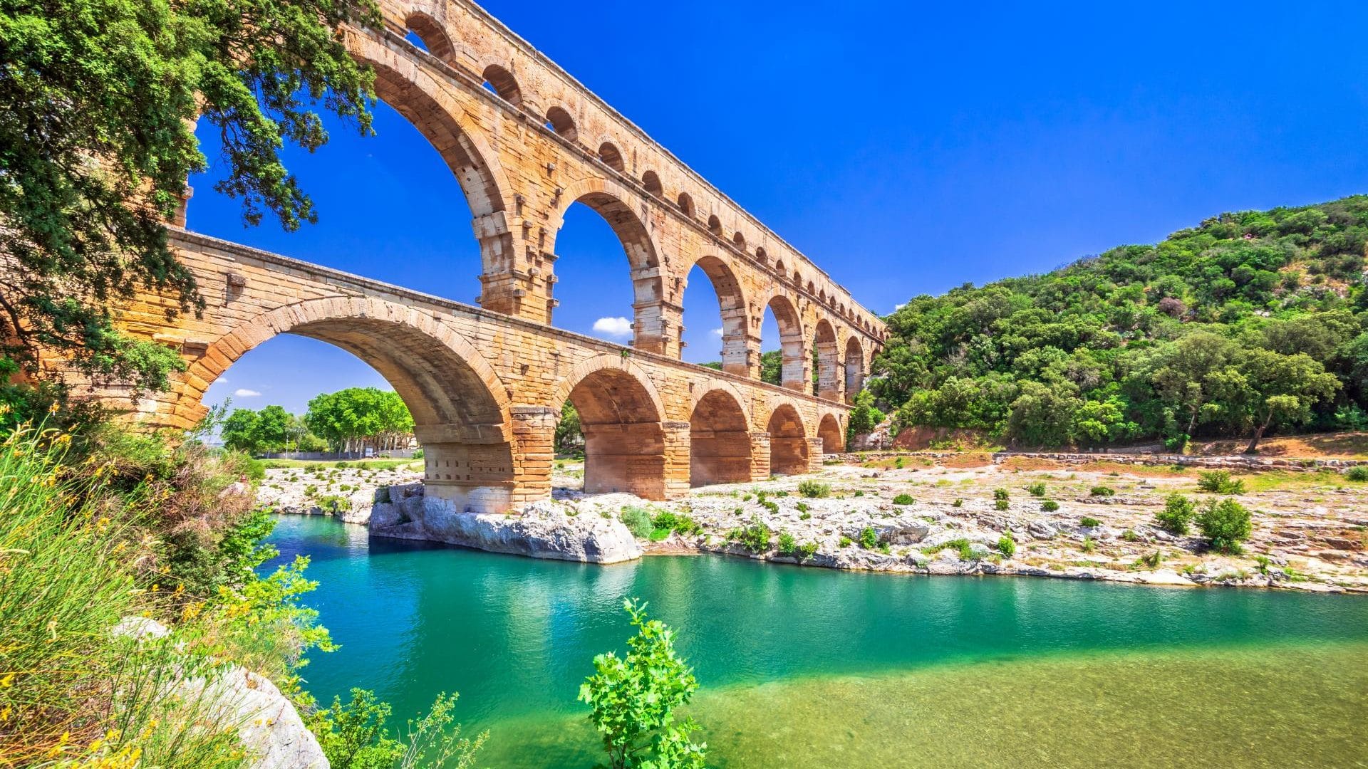
Discover the Pont du Gard near our campsite in Anduze, 60 kilometers from Le Pont. This famous monument is an ancient Roman aqueduct on three levels. Overlooking the river Gardon, the Pont du Gard provided a water supply from Uzès to Nîmes. Discover this majestic site from our 4-star Castel Rose campsite in the Gard.
The Pont du Gard is open all year round. Before you visit, find out about the opening times of the site in Provence Alpes Côte d’Azur.
Discover the Pont du Gard and its history. The site is one of the most prestigious remains of antiquity. The aqueduct stretches 50 kilometers from its source in Uzès to Nîmes. The site has lived through many stories over its 20 centuries, from its construction in 40 A.D., to its abandonment in 3ᵉ century, via its listing as a historical monument, and then its inscription on the Unesco World Heritage List. Take a stroll around the site and discover Roman remains along the footpaths.
The Pont du Gard has been a listed historic monument since 1840. It is also a UNESCO World Heritage Site.
Did you know that the Pont du Gard is the most visited ancient monument in France and the most visited tourist site in Occitanie?
The reputation of this exceptional natural site has spread far beyond the borders of the region, and is now known the world over.
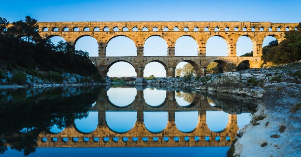
And with good reason: the Pont du Gard is the highest Roman bridge-aqueduct in the world.
It has been a UNESCO World Heritage Site since 1985.
Everything about it is fascinating: its age (built in the 1st century), the time it took to build it (5 years), its dimensions (275 m long and 49 m high), and its rare architecture with 3 rows of arches one above the other.
What to do around the Pont du Gard
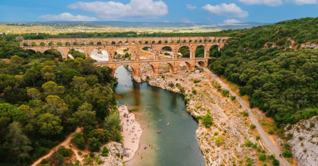
There’s plenty to do at the Pont du Gard: visit the site, the museum and temporary exhibitions, take a stroll or even swim in the river at the foot of the bridge.
You’ll find discovery areas along the way to immerse yourself in the history of this major French site. The museum presents the history of the Pont du Gard and the aqueduct, taking you on a journey through time. You’ll also find a documentary film to complement your knowledge of the site, as well as temporary exhibitions: scientific or artistic, every year.
The Pont du Gard lies between Nîmes and Uzès, two of the Gard region’s must-see towns.
Take a tour of Uzès, designated a “Ville d’Art et d’Histoire” (City of Art and History).
France’s oldest duchy is brimming with
historic and religious monuments (town houses, ducal castle, Saint-Théodorit cathedral, etc.)
Just outside Uzès, the Haribo candy museum is a delight for young and old alike.
Here, you can see a small production line, take part in interactive experiments and enjoy other surprises that are sure to delight every sweet tooth!
Nîmes is another city in the Gard region well worth a visit.
This pleasant historic town is home to numerous Roman monuments that have become must-sees in the region (the arena, the Maison Carrée, the halles…).
Stay at our campsite near the Pont du Gard
Our 4-star campsite near Pont du Gard in Anduze at the gateway to the Cévennes offers everything you need for a successful vacation. In the heart of nature, in a wooded park, you can stay in a comfortable mobile home rental in the Cévennes or on a magnificent riverside pitch. The water park, with heated pools, and activities at the campsite will keep you entertained throughout your stay.
Go on vacation to Anduze, in our 4-star campsite in the Gard region , and rent a mobile home or camping pitch for a stay with family or friends.
Enjoy a wide range of activities at our campsite in the Cévennes, with a water park for family fun along the Gardon river.
Le Castel Rose campsite in Anduze near the Pont du Gard enjoys a privileged location, close to some of the most beautiful sites in the Gard. During your family vacation, you’ll alternate between visits to the region’s remarkable sites and moments of relaxation and fun at the 4-star Gard campsite.
