Discover the Camargue
Would you like to discover the Camargue during your camping holiday in the Gard? Appreciated for its rich natural and cultural heritage, it offers a multitude of possibilities for walks and visits. Le Castel Rose takes you on a voyage of discovery so that you don’t miss a thing of this territory that’s well worth the detour!
Where is the Camargue?
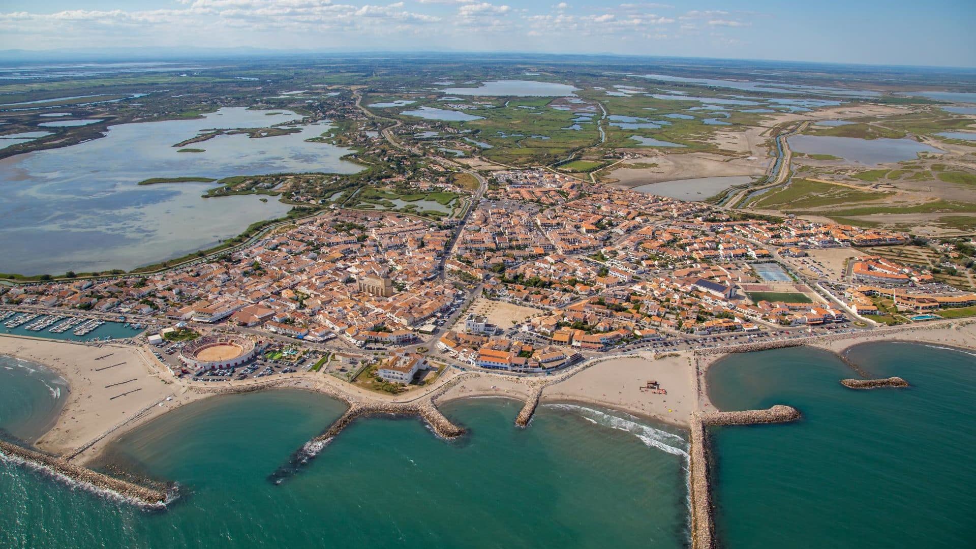
The Camargue (in Provençal Occitan: Camarga according to the classical standard or Camargo according to the Mistralian standard) is the marshy area formed by the Rhone delta. It’s a 145,300-hectare land area in the south of France, geographically situated between the two main arms of the Rhône delta and the Mediterranean Sea. It extends as far east as the Crau plain, as far west as Aigues-Mortes and as far north as Beaucaire. It thus extends across the Bouches-du-Rhône and Gard departments.
We distinguish 3 parts:
- the Petite Camargue to the west of the Petit-Rhône,
- the Grande Camargue, between the two arms of the Rhône,
- Plan du Bourg, to the east of Grand-Rhône.


What to see in the Camargue
Holidaymakers wishing to discover the Camargue through its natural and cultural sites will have no shortage of possibilities. Indeed, the region abounds in places not to be missed. Among them are :
- The Camargue Museum
- La Gacholle Lighthouse
- Pont du gau ornithological park
- The Camargue Horse House
- La Maison du Riz
- Ponds and lagoons
- The salt marshes
Which villages to visit in the Camargue?
With its many villages, the Camargue is a delight for lovers of beautiful walks. You can choose to visit just a few of them:
- Les Saintes-Maries-de-la-Mer
- Le Grau-du-Roi
- Aigues-Mortes
- Le Sambuc
- Gallician

Reaching the Camargue,its flora and fauna
At its center is the Etang du Vaccarès, while the seaward section is lined with salt ponds. The Camargue is essentially located in the communes of Arles, which is the largest commune in mainland France, Saintes-Maries-de-la-Mer and Port Saint Louis du Rhône.
This region is made up of two parts: the north, with its agricultural land, and the south, with its marshes and saltwater bodies that form a unique ecosystem. This ecosystem features vegetation mainly composed of saltwort and halophilous plants (i.e. plants that tolerate salt water) such as saladelle. It is also an area where horses and bulls are bred, rice is grown and salt is extracted (salt marshes).
This particular flora and fauna led to the creation of a national nature reserve covering 13,117 hectares (1927) and a regional nature park covering 30,000 hectares (1970). Annual evaporation is greater than rainfall, so the river makes up the difference, preventing the region from being burnt by salt.
The Camargue is a site of major European and national importance for local birds, for migratory birds and particularly for wintering birds, since in 2000-2005 it was the leading French site in terms of the number of wintering birds welcomed each year (122,000 birds, ahead of the Arcachon basin, which welcomed 105,000).
Discover the Camargue Regional Nature Park
The Camargue Regional Nature Park was created in 1970. The manadiers want to promote the Camargue (horse) but also the AOC Taureau de Camargue, the result of the development of two cattle breeds, the Camargue (cattle breed) and the Brave.


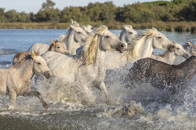
Where can you see wild horses in the Camargue?
Horse-riding enthusiasts will also have plenty of time to enjoy the organized rides through the park.
- La Bergerie d’Alivon
- Marais du Vigueirat & Manade Coule
- Mas Saint-Germain
- Mas de la Grenouillère
- Manade de Méjanes in Saintes Marie de la Mer
Where to go in the Camargue to see flamingos?
Looking for the Camargue’s famous pink flamingos? There are several places where you can observe them. You’ll find them at
- At the Pont du Gau ornithological park
- La Tour Carbonnière,
- The salt marshes of Aigues-Mortes,
- La Pointe de l’Espiguette,
- Réserve naturelle des marais du Vigueirat.

Locations in Camargueor nearby
- Arles
- Grau-du-Roi
- Beaucaire, the Camargue’s “northern gateway
- Tarascon, the Camargue’s “northern gateway
- Nîmes
- Fourques
- Bellegarde
- Aimargues
- Saint-Laurent-d’Aigouze
- Aigues-Vives
- Saint-Gilles
- Gallician
- Franquevaux
- Le Cailar
In the Camargue
In its most restrictive sense, the Camargue lies between the two arms of the Rhone delta.
- Trinquetaille (Arles district)
- Les Saintes-Maries-de-la-Mer
- Salin-de-Giraud
- Port-Saint-Louis-du-Rhône
In the Petite Camargue
To the west of today’s delta, the Petite Camargue corresponds to an area formerly occupied by vanished branches of the Rhône, which watered the Languedoc coast between Beaucaire and the sea. Historical times have preserved some traces of this configuration, probably with a delta that had already begun to shift eastwards (over time, the mouths of the Rhône have moved from west to east):
- the Spanish branch mentioned by Latin authors
- and more recently, in the Middle Ages, the arm that passed under Saint-Gilles before losing itself in the ponds connected to the sea near today’s Grand-Motte or Maguelonne.
Today, the Petit Rhône may be considered a remnant of this historic branch, at least in its upper reaches from Arles to Saint-Gilles.
The future of the region
The Camargue coasts are undergoing an intense and contrasting transformation, with areas of maritime erosion around Les Saintes-Maries-de-la-mer and opposite Faraman, and fattening zones mainly around the mouth of the Grand Rhône, Beauduc and the Espiguette lighthouse (Grau-du-Roi).
It should also be added that the entire delta and its lowlands are beginning to feel the effects of global warming: rising salt levels linked to rising sea levels, etc.
The Camargue is also a stake for numerous political and economic interests, involving a wide range of stakeholders: the Camargue Regional Nature Park, government ministries, property developers, regional planners, the Salins du Midi, livestock breeders, farmers, hunters, tourism professionals, Rhône protection organizations, the municipalities of Arles and Saintes-Maries-de-la-Mer, regional authorities, etc.
Article source: Wikipedia


